Steps for Creating Your Own Google Map
Extension
Now that you have studied the areas affected by the Dust Bowl and drought, can you figure out the migration route people followed to escape the devastation? Look at your map, what route would someone follow to go from:
If time permits:
- Sign into Google
- In Google find the checkerboard icon and find “Maps” (You may have to go to Even More)
- Now click on where it says, “My Custom Maps”
- Go to the Create icon and give the map a name (click on where it says “Untitled”): Name your map - “Mapping the Great Depression (period and group name)”
- On this map, you will be recording a couple of things:
- The Dust Bowl area
- The Drought area
- The migration paths to Los Angeles, CA, San Francisco, CA and Portland, OR
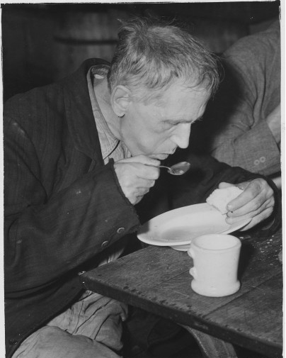
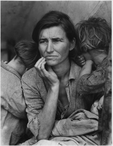
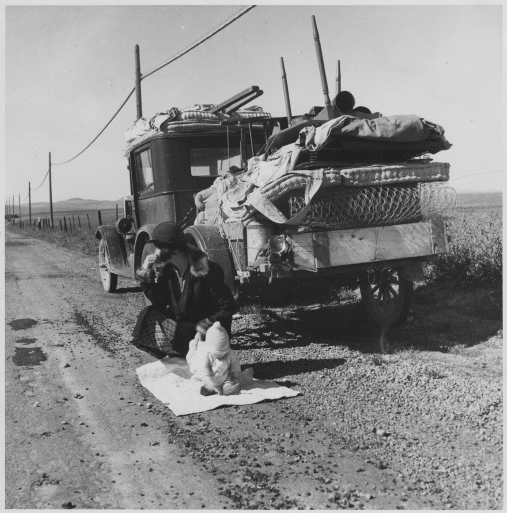
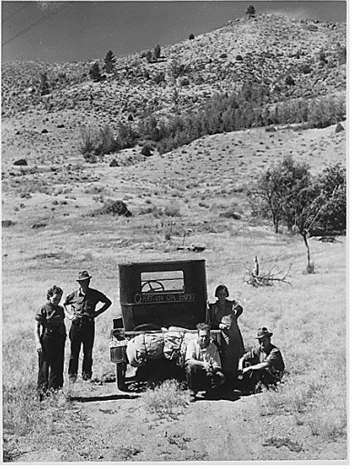
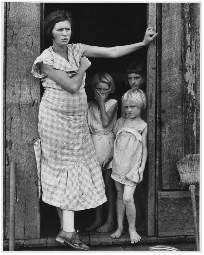
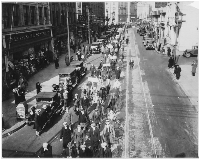
- Where the Great Depression pictures stored in the shared picture folder were taken..
- Click on “Untitled layer” and label it “Dust Bowl area” ) and use the “Draw a line” tool to create the Dust Bowl area. Make sure that you connect your first and last dot to bring up the labeling box (label it Dust Bowl) - You will now color that area RED by hovering on the title Dust Bowl on the Layer Dust Bowl - a paint can will appear - click on the paint can and select RED
- Unselect the Dust Bowl layer by clicking the check mark to remove it on that layer.
- Move to the Drought Area layer by clicking on it - Using the “Draw a liner” tool identify the area affected by the drought (label it Drought area). You will now color that area YELLOW by hovering on the title Drought area on the Layer Drought areal - a paint can will appear - click on the paint can and select YELLOW.
- Add a new Layer (label this layer - Images)
- A folder titled, “Pictures for the Dust Bowl Map Project” has been shared with you. You will need to place each of these pictures in the correct location on your map. To do so, go to your Google Drive and locate the folder, click on the first picture that you want to place on the map. When you open the picture, it will open with a grey background. On the bottom right you will see, OPEN - click here and open with Google Drive Viewer. Copy the URL for this picture.
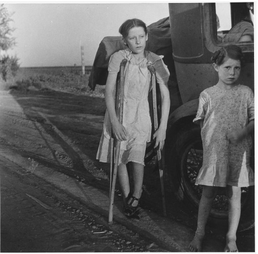
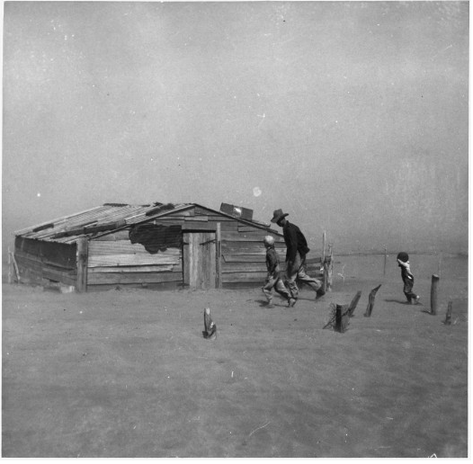
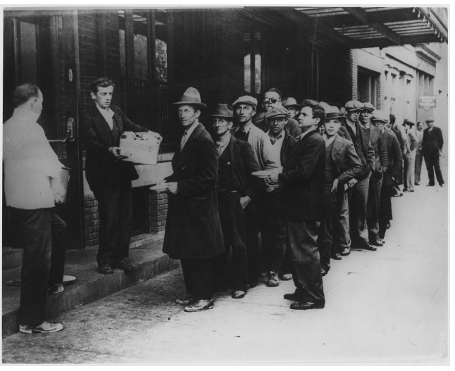
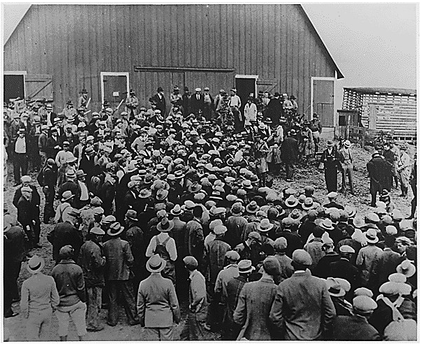
- Now make sure you are on your Images layer - Use the “Add Marker” tool, place the marker on the correct location for the picture. Title the picture the name of the town with description on the picture. (example: Oklahoma City- soup kitchen). Once you have named it, click on the camera - then click URL - and paste the address. All markers for this layer should have a title containing the name of the town and a short description of the picture.
Extension
Now that you have studied the areas affected by the Dust Bowl and drought, can you figure out the migration route people followed to escape the devastation? Look at your map, what route would someone follow to go from:
- Oklahoma City, OK to Los Angeles, CA?
- Hastings, NE to Portland, OR?
If time permits:
- use the “Draw a line” tool to draw the path that the migrants followed to get from Oklahoma City, OK to Los Angeles, CA (color that line green)
- Using the “Draw a line” tool to draw the path that the migrants followed to get from Hastings, NE to Portland, OR (color that line orange)